


More Info
- (724) 463-8636
- Indiana County Parks & Trails
- Detailed map
- Trailhead GPS Coordinates
- Interactive Maps
Quick Notes
- Do not use the trail when the Conemaugh River is flowing over or close to it.
- The trail is located close to three rail-trails that total almost 70 miles in length.
- Wear bright colors during hunting seasons.
- Pets must be leashed, and owners must clean up after them.
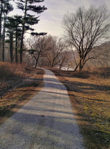

Blairsville Riverfront Trail
 Why
develop a trail in a flood plain? Ride or walk it, and you’ll
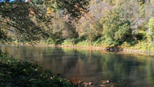
learn why: It’s beautiful! Separated from the community, the
trail offers wonderful river views and peaceful woodlands filled
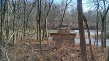
with birdsong. While only 1.7 miles long, the Blairsville
Riverfront Trail runs within a stone’s throw of the Conemaugh
River for its entire length. The land it crosses is owned by
the U.S. Army Corps of Engineers, which maintains a
flood-control dam seven miles downstream. The Corps keeps the
surrounding property undeveloped because the dam’s reservoir
occasionally backs up this far during wet periods.
Why
develop a trail in a flood plain? Ride or walk it, and you’ll
learn why: It’s beautiful! Separated from the community, the
trail offers wonderful river views and peaceful woodlands filled
with birdsong. While only 1.7 miles long, the Blairsville
Riverfront Trail runs within a stone’s throw of the Conemaugh
River for its entire length. The land it crosses is owned by
the U.S. Army Corps of Engineers, which maintains a
flood-control dam seven miles downstream. The Corps keeps the
surrounding property undeveloped because the dam’s reservoir
occasionally backs up this far during wet periods.
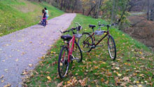
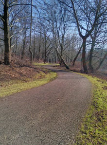
Trail Description
With the exception of a short rise up to the West Market Street trailhead, the trail is virtually flat. Because of periodic flooding, developers used a durable tar-and-chip trail surface. The dedicated trail extends from West Market Street to Wyotech Park. However, users can create a complete loop by traveling on low-traffic Blairsville Borough streets. In the stylish downtown, they can enjoy restaurants, a coffee shop and other amenities.
Trailheads
View Blairsville Riverfront Trail Trailheads in a larger map
Challenges
- The only challenge of this trail is riding many miles. However, three other major rail-trails have trailheads within a couple of miles of Blairsville.
- Occasional flooding closes the trail. Do not attempt to use the trail during high-water periods. Contact Indiana County Parks & Trails at (724) 463-8636 for current conditions.