


More Info
- Cambria County Conservation and Recreation Authority
(814) 472-2110 - Indiana County Parks & Trails
(724) 463-8636 - Cambria County Conservation and Recreation Authority
- Indiana County Parks
- Trailhead GPS Coordinates
-
Interactive
Maps
Quick Notes
- The Ghost Town Trail totals 44 miles in length over three branches.
- There are extensive climbs, however all grades are less than 3%.
- This is a designated National Recreation Trail.
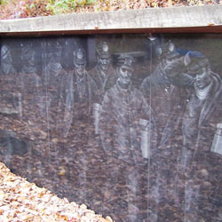
- Two iron furnaces, other historical structures and numerous interpretive markers are along the trail.
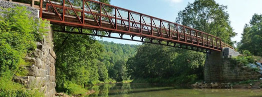
- Several exquisite bridges to check out along the way!

Ghost Town Trail
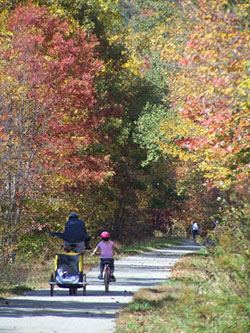 Natural
beauty, fascinating historical features, and length: The Ghost
Town Trail blends that and throws in a bit of challenge for
flavor. Named for the long-gone coal-mining communities that
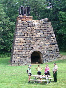
once dotted its right-of-way, the GTT flows past two massive
iron furnaces, old coal-loading tipples, boney (coal-refuse)
piles and other traces of industrial history. The Blacklick
Creek valley in which it is situated is gorgeous, with mountain
streams, stands of rhododendron, dozens of wildflower species
and cool woodlands.
Natural
beauty, fascinating historical features, and length: The Ghost
Town Trail blends that and throws in a bit of challenge for
flavor. Named for the long-gone coal-mining communities that
once dotted its right-of-way, the GTT flows past two massive
iron furnaces, old coal-loading tipples, boney (coal-refuse)
piles and other traces of industrial history. The Blacklick
Creek valley in which it is situated is gorgeous, with mountain
streams, stands of rhododendron, dozens of wildflower species
and cool woodlands.
 Trail
Description
Trail
Description
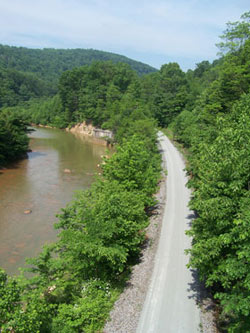
As it climbs the western slope of the Allegheny Front, the Ghost Town Trail totals 44 miles in length. There is a:
- 32-mile main stem from Blacklick to Ebensburg.
- 12-mile C&I extension includes:
- 4-mile Rexis Branch from Vintondale to U.S. 422.
- 8-mile Stritty's Way from U.S. 422 to Expedite Road.
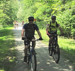
The GTT has a crushed limestone surface. At Vintondale, the trail divides and follows two branches of Blacklick Creek.
Trailheads
The Dilltown Access Area of the Ghost Town Trail is located on Route 403 one mile north of Route 22. Google map directions are incorrect.
Trail Challenges
- Portions of the Gost Town Trail involve extensive climbs, however, all grades are less than 3%.
- Users cross underneath US 422 to connect between the Rexis and C&I branches.