


More Info
Quick Notes
- This trail is beautiful and historical.
- Portions of the Conemaugh River Lake Section occasionally are submerged or debris-covered.
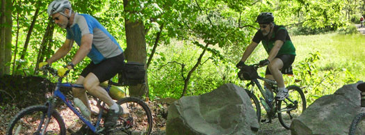
- There are challenging climbs over Bow Ridge, around the Conemaugh Dam and across the Dick Mayer Section.
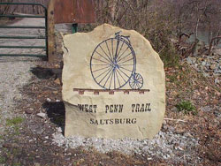
- The trail travels between two historic towns, Saltsburg and Blairsville.
.jpg)
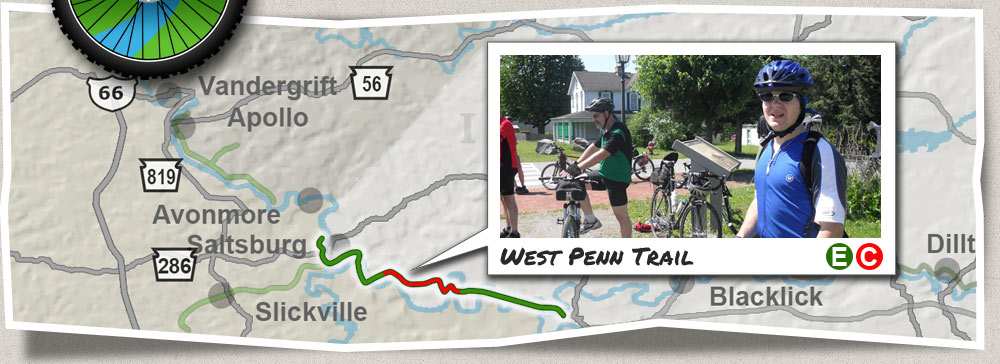
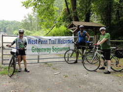
West Penn Trail
 This
trail traces time and nature’s beauty! While named for the West
Penn Railroad that once ran along the Conemaugh River valley,
this 15-mile trail also follows the original right-of-way of the
Main Line Canal. Traces of the old canal, early railroad tunnels
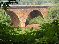
and beautiful cut-stone bridges all can be seen. But this trail
also offers an outstanding natural experience by bringing the
user across Conemaugh River Lake, over Bow Ridge, past the dam
itself and finally along the Conemaugh River into Saltsburg.
This
trail traces time and nature’s beauty! While named for the West
Penn Railroad that once ran along the Conemaugh River valley,
this 15-mile trail also follows the original right-of-way of the
Main Line Canal. Traces of the old canal, early railroad tunnels
and beautiful cut-stone bridges all can be seen. But this trail
also offers an outstanding natural experience by bringing the
user across Conemaugh River Lake, over Bow Ridge, past the dam
itself and finally along the Conemaugh River into Saltsburg.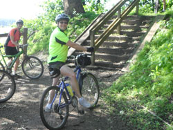
Trail Description
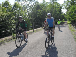
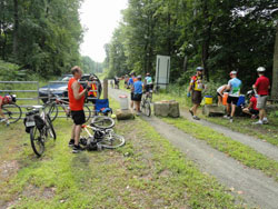
There are three distinct sections of the West Penn Trail. From east to west: the 4.5-mile Conemaugh River Lake section is an easy ride on a tar-and-chip surface that crosses four stone-arch bridges. At Bow Ridge, a set of steps and rollway enable the cyclist to walk up a steep slope and switchbacks to the top. Paved, low-traffic roads take the user past the Conemaugh Dam to the Dick Mayer Section. The Bow Ridge, dam roads and Dick Mayer Section combine for another 4.2 miles. Finally, the 6-mile Saltsburg and Kiski sections are nearly flat rail-trail that takes the user through Saltsburg.
For many trail users, the hilly sections of this trail offer a unique and exciting alternative to straight, flat rail-trail without the extreme challenge of mountain biking. Covering these sections early in the ride will ensure the best experience.
Trailheads
Trail Challenges
- Sections of the Conemaugh River Lake Section of the West Penn Trail occasionally are submerged under the backwaters of the Conemaugh Dam. This generally happens about 3-4 times per year, more often in the springtime, and can last anywhere from one to several days. The water covers the bridge closest to the Bow Ridge tunnel first, then can back up as far as three miles toward the Westinghouse and Newport Road trail heads.
- To check the water level, call the Army Corps of Engineers office at the Conemaugh Dam at (724) 639-3875, or check the ACE Website and scroll down to the chart labeled USGS Conemaugh Lake. If the water level is 911 feet or higher, the bridge closest to the tunnel is under water.
- Climbing Bow Ridge involves pushing a bike on a runway beside a set of steps, then riding or walking up a couple of fairly steep switchbacks.
- There are steep grades along the roads within the Conemaugh Dam recreation area.
- The Dick Mayer Section involves challenging climbs along packed dirt trails.